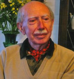
Lawrie Williams was the only member of the remarkable geological mapping team in the 1950s, in the Geological Survey of Kenya under the direction of Dr William Pulfrey (Chief Geologist), who was brought up in Kenya. He was born in Nairobi in 1930. He obtained his first degree from Glasgow University in 1952, with first class honours. Lawrie was arguably the most technically proficient and resourceful of the Kenya survey geologists, several of whom went on to distinguish themselves in other fields after ‘Uhuru’.
He was noted for tackling the really wild areas such as the Mara River and Amboseli, and he had several scaring adventures with unfriendly lions. He also mapped the Haidu Fundi Isa, Chandlers’ Falls, and Buna-Korondil Sheets. He had a most even temperament, and I never knew him to have any disagreement with his colleagues; he was always ready to help them and many times I took difficult thin sections to him for a second opinion – he was much better at mineralogical niceties than myself!
He moved to the University College (later the University) in Nairobi in 1963 and obtained a PhD at that institution. While there he was involved with EAGRU, a two-pronged organisation based in Bedford College under Basil King and Bill Bishop, and Leicester under Mike Le Bas. The former concentrated on the Baringo District in the Gregory Rift, where Lawrie, as a co-director, acted as anchor man for the students while on field work in Kenya. The latter concentrated on the carbonatites bordering Lake Victoria, in the Gwasi area, which I had mapped in 1954, obtaining some more detail.
His last professional move was to Lancaster University as Senior Lecturer in 1972, where he continued his Kenya researches. He was later promoted Reader. He co-authored a definitive report in the
JGS in 1995 on the splendid Silali caldera volcano with myself, who did the original two mapping trips from the University in Perth (the second supported by EAGRU), and geologists from the BGS who carried on the work and produced the 1:50,000 scale BGS map of the Kapedo area in which Silali forms the centre.
He retired in September 1990 as an Emeritus Reader, and continued to reside near Carnforth with his wife, Sylvia, who describes him as a wonderful husband and friend. He was an outstanding geologist and a very fine man, and his contribution to the unravelling of the very complex geology of Kenya was immense. His quiet but strong personality will be much missed.
Joe McCall